Mapping natural radioactivity
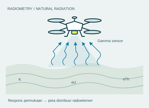
Radiometric sensors measure gamma energy from the surface to help understand material variations, lithology, and anomalous zones.
 Discuss your survey
 INAERO / GEOPHYSICS
Airborne surveys help collect geophysical data more quickly across large or hard-to-reach areas, or where lighter ground access is needed.
Discuss survey requirements ↗01 / WORKFLOW
Five stages of drone geophysics: carrying sensors, recording data, and turning measurements into a basis for field investigation.
The drone follows planned survey lines to carry sensors over the study area.
Sensors record magnetic fields, electromagnetic responses, natural radiation, or elevation according to the survey method.
Data are checked for noise and positioning quality, corrected for the method, and processed into maps or models with quality-control records.
Differences in the measured response are analysed to identify geological structures or zones requiring further investigation.
Selected anomalies become targets for further investigation, taking supporting geological data into account.
02 / SERVICES
We help align platforms, sensors, flight paths, and data outputs with your geological or operational questions.
Radiometric sensors measure gamma energy from the surface to help understand material variations, lithology, and anomalous zones.
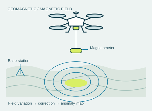
Magnetic surveys map variations in the magnetic field for geological mapping and exploration targeting. System design must consider drone interference, positioning quality, and corrections appropriate to the survey objective.
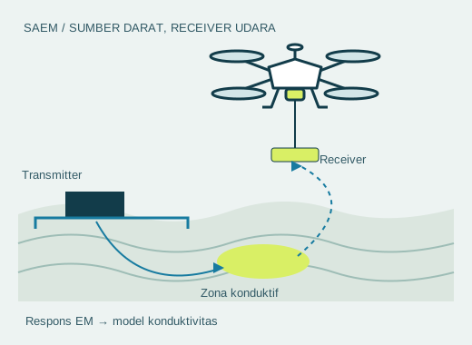
SAEM combines a ground-based electromagnetic source with a drone-borne receiver to estimate conductivity variations.
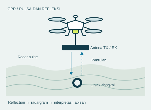
Ground Penetrating Radar sends electromagnetic pulses into the ground to help detect utilities, layers, voids, or shallow objects.
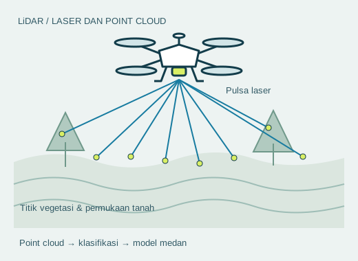
LiDAR produces three-dimensional points for DTMs, DSMs, contours, and terrain analysis across the survey area.
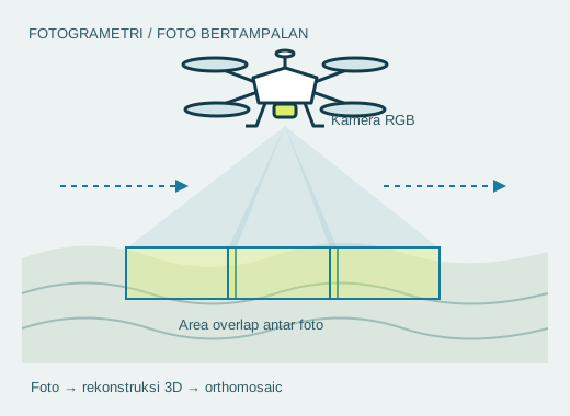
Aerial photographs with planned overlap are processed into orthomosaics, 3D models, and maps to support geological interpretation and fieldwork.
03 / SURVEY METHODS
Each method is selected according to the geological target, investigation depth, field access, and required data output.
This method measures variations in the Earth's magnetic field using a high-sensitivity magnetometer mounted on a UAV. Rapid, high-resolution acquisition supports mapping geological structures, faults, lithology, and magnetic mineralization across challenging terrain.
Gamma-ray spectrometers mounted on UAVs measure natural radiation from potassium (K), uranium (U), and thorium (Th) in surface materials. The data supports geological mapping, alteration zone identification, environmental assessment, and mineral exploration.
Drone EM measures variations in subsurface electrical conductivity to map geological structures and conductive targets. UAV acquisition supports mineral exploration, groundwater investigations, environmental studies, and engineering applications.
SAEM combines a ground-based controlled-source transmitter with a drone-mounted electromagnetic receiver. This hybrid method supports deeper, high-resolution investigation of conductive bodies, sulfide mineralization, aquifers, alteration zones, and geothermal targets.
VLF uses radio signals from existing communication stations to detect shallow conductive structures such as faults, fracture zones, shear zones, groundwater pathways, and near-surface mineralization. Drone VLF enables fast, dense coverage for reconnaissance surveys.
INAERO × MGT / SAEM SURVEY
Documentation of INAERO's collaboration with MGT on a Semi Airborne Electromagnetic (SAEM) survey. This method combines a ground-based electromagnetic source with a drone-borne receiver to investigate subsurface electrical properties.
DATA QUALITY / SURVEY PLANNING
A survey starts with geological questions and data requirements. Sensor selection, flight design, and processing levels must suit the investigation.
Discuss targets, coverage, required resolution, sensor positioning, and deliverables. Use current terrain information and imagery to plan survey lines, safe clearance, access, and field coordination.
Plan system checks, positioning quality checks, and assessment of drone and environmental interference. Agree how to monitor noise and when data should be reacquired before work starts.
Select corrections and processing appropriate to the method and survey goals. Document the processing steps and checks so users understand how raw data become interpretation products.
Define requirements for raw and corrected data, positioning information, maps or models, and quality reports. Explain limitations and processing levels so the data can be assessed for subsequent investigations.
Project parameters and tolerances should be set with geophysical specialists experienced in the selected method.
Methodology reference: Geoff Pettifer — BCGS Drone Symposium (05:06–07:40, 10:12–11:50, 13:20–14:36). The presentation discusses the development of voluntary good-practice guidelines.
03 / SUPPORTING PLATFORMS
INAERO adapts platform and payload selection to coverage, terrain, and the required survey outputs.
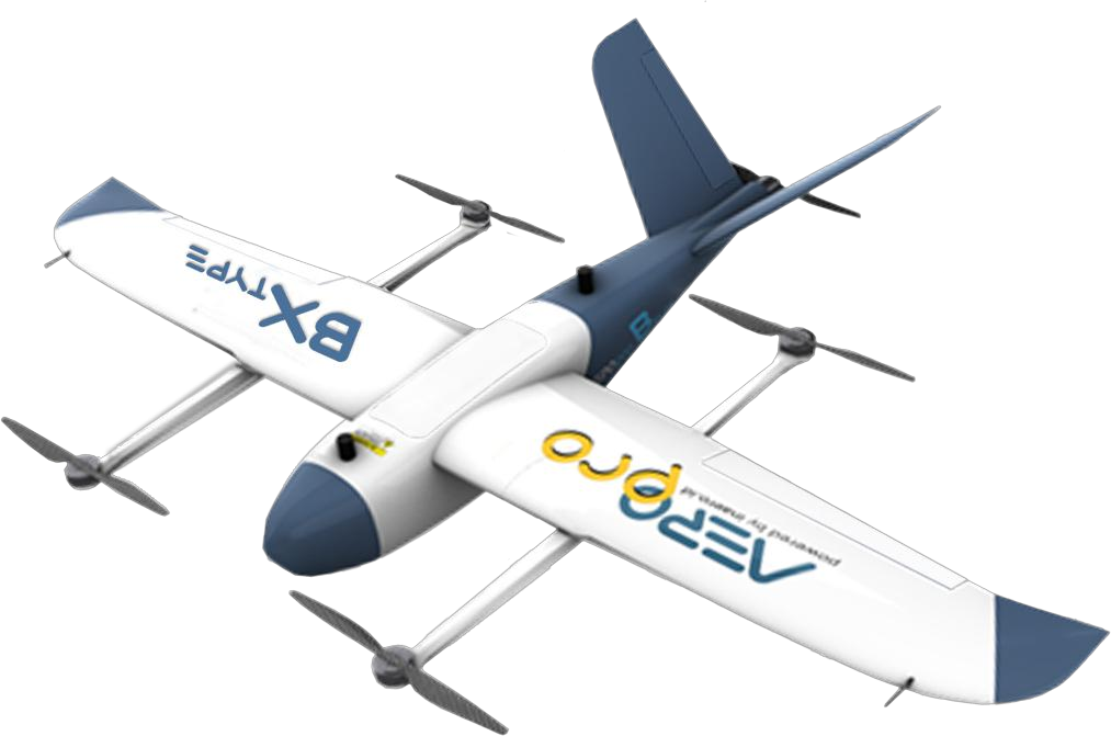
For broad coverage and missions with planned flight paths.
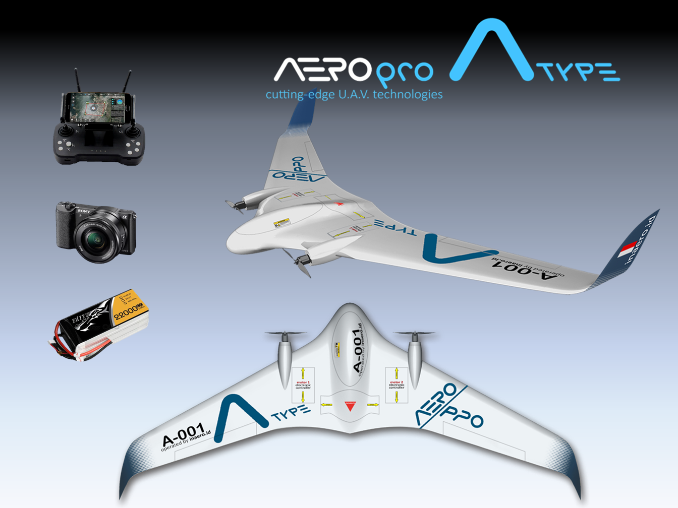
A lightweight platform for mapping and observation cameras and sensors.
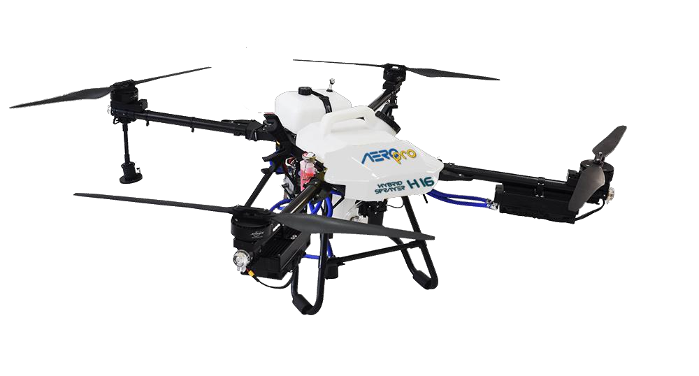
A longer-duration configuration for specific payload requirements.
04 / DELIVERABLES
Survey results can include maps, profiles, elevation models, anomaly maps, and material for planning the next steps. Deliverables depend on the method, sensors, and project goals. Agree on processing levels, metadata, and quality reports so results can be reviewed and reused.
Discuss data outputs ↗START A CONVERSATION
Tell us the location, area, investigation goals, and required outputs. We can help select a geophysical approach and drone configuration.
Drone for
industry.